Darwin Aquifers are Filling
Aquifers in the greater Darwin area have responded positively to the recent monsoon rainfall experienced during January.
The most significant increase was recorded at the Howard Springs (Mt Partridge formation) monitoring site with a 14.2m rise in the water level, meaning it is now 50cm below ground level.
DENR water resources acting executive director, Simon Cruickshank, said the variation in water levels is attributed to several factors including:
· How wet the receiving area was prior to the monsoon event
· The permeability of the geological material; this is the more spaces and cracks in the sub-surface soils and aquifer, the quicker water will move through the aquifer
· The amount of impermeable surface an area has – built up localities have a high ratio of developed land where rainfall runs off into streams before it can infiltrate into the ground
· How flat the receiving area is – rain that falls on steep country will run-off before infiltration occurs
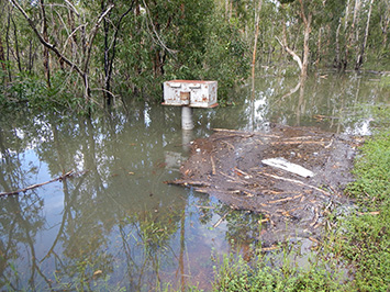
Mr Cruickshank said roadside signs in Darwin’s rural area have now been updated to reflect the impact of the monsoonal event on aquifers.
“Rural residents are reliant on groundwater so it’s important that residents are aware how dynamic the resource is and the impact water extraction has on that resource throughout the year,” Mr Cruickshank said.
“The signs are a reminder to local residents of the variability of groundwater levels during the year.
“The four roadside signs have been installed at Berry Springs, Howard Springs, Humpty Doo and McMinns Lagoon, giving rural residents a ready snapshot of water tables in their area.”
Detailed hydrographs for each monitored site in Darwin’s rural area can be found at https://denr.nt.gov.au/land-resource-management/water/water-management/Darwin-rural-groundwater-watch
Ends
Media Note - For further information / interview please contact Simon Cruickshank on 89244135.
Water table graphic - January 2018 (jpg 144 kb)
Berry Springs - Water Hydrograph (pdf 170 kb)

