The Northern Territory has a New Water Control District
The Daly Roper Water Control District has been extended to include the Beetaloo Sub-basin and is now called the Daly Roper Beetaloo Water Control District.
Department of Environment and Natural Resources (DENR) water planning and engagement Director, Tim Bond, said the change is in line with recommendation 7.7 of the Final Report of the Scientific Inquiry into Hydraulic Fracturing in the Northern Territory https://hydraulicfracturing.nt.gov.au/
“The extension is 41,313 square kilometres and includes Dunmarra, Elliott, Newcastle Waters to the west, Powell Station to south and Mungabroom Pastoral Leases to the east,” Mr Bond said.
“The new Daly Roper Beetaloo Water Control District is 175,580 square kilometres, which is two and a half times the size of Tasmania.”
The extension will establish new water management rules to people wanting to access and use water in the extension area, which:
· Includes a requirement for bore construction permits and for water extraction licences to take surface and groundwater; and
· Allows for water allocation plans to be developed.
Mr Bond said it was important to note that water for rural and domestic use is exempt from licensing and that there is an exemption if the combined groundwater use from all bores located on a parcel of land is less than five megalitres per year.
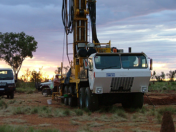
The Beetaloo Sub-basin is a geological formation that is highly prospective for shale gas extraction.
A Water Control District boundary deals with surface and groundwater boundaries that do not necessarily correlate neatly with underlying geological structures.
The Daly Roper Beetaloo Water Control District Gazette notice and map can be found at: www.nt.gov.au/…/water-resources-of-…/water-control-districts