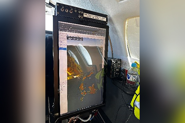
Remote sensing technology
Recent fires in the Barkly district have highlighted the benefits of using remote sensing technology in bushfire management to collect, process and deliver timely sensory data and spatial information, and accurate assessment of the fire risk, conditions, extent and fire behaviour. This imagery also assists in making informed decisions and the issuing of public warnings during fire events. The software processes data from cameras and other sensors, then geo-references and displays that data in real time.
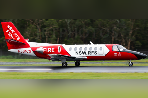
On Wednesday 13 September, a crew of 3 aviation specialists from the NSW Rural Fire Service (RFS) flew to Tennant Creek on the RFS Citation (Fire Scan 201), to assist Bushfires NT and NT Police, Fire and Emergency Services with a number of bushfires, including the Barkly Complex Fire, which had been burning for more than a week.
The imagery collected was then processed into Fire Mapper, which assisted the Incident Management Team with prioritising tasks and identifying areas of higher risk, through analysis of detailed thermal composite images and hotspots data along with fire progression and fire behaviour. The imagery was also utilised to update the burnt area in Fire Mapper and fire progression modelling. This in turn also assisted with situational awareness and safety of personnel on the fireground.
The Barkly fire was largely driven by the slow-moving high pressure system associated with predominately south-easterly winds, gusting to 55 km/h. The fire was fuelled by cured grass with associated high fuel loads, as a result of rainfall earlier this year. Rates of spread across the fireground were variable as it was subject to changes in weather, and variation in terrain and vegetation.