Five days with the Water Monitoring Branch
The Water Monitoring Branch monitors groundwater and surface water across the Northern Territory, managing over 160 surface water and 580 groundwater sites.
The team is made up of both technical and professional officers with qualifications such hydrography, environmental science and hydrology. Team members take samples of water to analyse water quality and measure depth and flow in rivers, creeks and streams as well as depth to groundwater. Monitoring data feeds into many things such as flood alerts for roads and communities, rainfall and river levels for the Bureau of Meteorology systems, validation of computer models predicting flow and storage volumes of water, information for water allocation planning and environmental impact statements and evidence for compliance with water extraction and waste discharge licences. This valuable data is available to the world, go to the the Northern Territory Water Data Portal website.
This is a busy time of the year for the team as the weather transitions from dry season to the wet season. Monitoring is underway to record the conditions at the end of dry season, while preparations begin for the coming wet season, ensuring infrastructure is operational and able to cope with the extreme conditions. This increased workload coincides with one of the hottest parts of the year when temperatures can exceed 40°C and humidity is high. The team doesn’t just prepare to work in hot conditions either, working in and around water means managing risks from crocodiles, snakes, buffalo and pigs. As well, there are risks from equipment such as four-wheel drives, all-terrain vehicles, boats, drills, chainsaws, line trimmers, weed sprayers and working on elevated platforms. Here is a snapshot of what the team undertook in just 5 days of October.
Monday
The morning started with a team meeting to outline what was ahead for the week and if any resources needed to be diverted to ensure project delivery. Three teams would be monitoring to support the Water Allocation Plans for both the Katherine-Tindall and Oolloo-Tindall regions. All paperwork, including approvals and work health safety plans, plus equipment preparation and vehicle packing was completed last week.
The teams were ready to start the 320 km drive south to Katherine and begin work at the first sites on their programs in the afternoon. One of the teams suffered a vehicle breakdown near Pine Creek and a second team needed to troubleshoot a faulty fuel tank switch before they could get going again. One of the teams used a brand new Acoustic Doppler Current Profiler (ADCP) and was suspicious of the results. After further testings and a swap with another team, it appeared the ADCP was faulty.
A fourth team drove 90 km east to Marrakai to install loggers in 9 new groundwater monitoring bores installed recently by the drilling team. The loggers measure and record the water level in groundwater, important information for hydrogeologists and water resource planners to inform the Adelaide River Water Allocation plan. The team expertly set up these loggers using their field laptops and then hung them at the correct depth using stainless steel cable in the bore to log for the next 5 years. The team will be back in a couple of months to make sure they are all operational and then they will visit every 6 months to download the logged data.
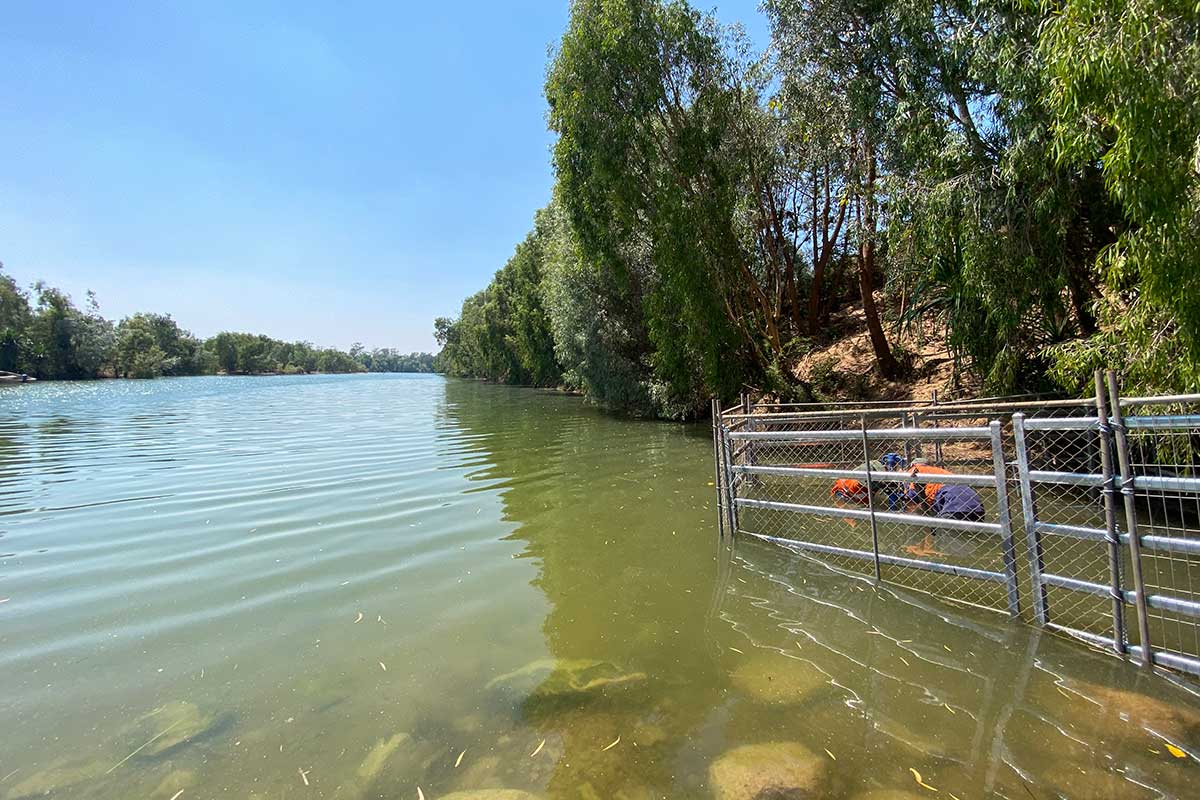
A fifth team was back from a 2,000 km trip to Borroloola. They had spent all last week with a directional drilling contractor to install a new orifice line from the gauging station into the McArthur River. Orifice lines are pipes that protect the cables connecting the sensors in the river with the logging and communications equipment in the gauging station tower. Rather than digging a trench that can weaken the bank and cause erosion, the team organised a direction driller to drill a line.
It is a dangerous spot though, with plenty of crocodiles, and the team needed to get in the water to connect the orifice line. It meant organising crocodile panels to place in the water to stop any crocodiles from grabbing the team. The team got the job done using the panels, plenty of spotters and firearms at the ready. Now it was time to unpack the vehicle, close all approvals in the management systems and debrief with the operations manager and discuss any issues.
Hot and humid conditions were an issue, with heat stroke a real risk, plus the team had used crocodile panels so the operation debriefs are important to ensure we don’t repeat mistakes.
Tuesday
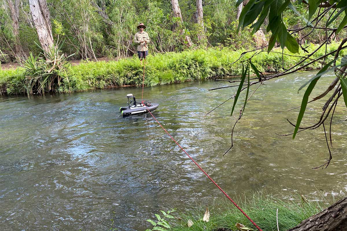
The 3 teams in Katherine started another day early, getting out to sites to conduct flow gaugings in the rivers and creeks across the catchment. The teams use ADCPs to measure how fast water is moving across the water column. They move their ADCP across the river channel to measure the flow. They also survey and record the river height at which the flow gauging was taken to relate a river level with a flow. When they do this enough times at the same location for different river levels, they can then construct what is called a rating curve, which is a graph that has river level on one axis and flow on the second axis. The gauging station constantly measures river level and transmits the river level data back to water resource computers. These river levels are then converted into flow using the rating curve for that site.
Rivers are constantly changing as they erode and deposit sands and sediments, so it is important to maintain the accuracy of the rating curve by regularly monitoring the flow at different river levels.
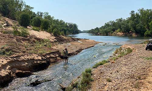
Some of the sites the teams had to attend on Tuesday are hard to get to. Driving on unused tracks, winching themselves across river crossings in very remote locations. At least it is dry this time of the year, so they are not contending with mud and swollen rivers.
The fourth team had moved on from the Marrakai work to measure the depth to groundwater in monitoring bores in the Black Jungle and Lambells Lagoon area.
The fifth team unpacked and debriefed and was troubleshooting a problem gauging station on the Adelaide River. The gauging station uses an older style water level system that involves a float connected to a steel tape on a device called a shaft encoder. The float moves with the rise and fall of the river level and moves the steel cable which in turn moves the wheel on the shaft encoder to record the changes in water level. Based on the data coming, it looks like the cable has come off the wheel. It is an important site for water allocation planning in the Adelaide River Catchment and to the design of the Adelaide River Offline Water Storage (AROWS) project, so the team plan to returnto repair the station.
Wednesday
The 3 Katherine teams were out early again. One of the teams was on the Katherine River, conducting a gauging from the boat. The outboard motor developed an issue and stopped. The team had to row back to their launch site and call back to the office for assistance. Four gauging sites would not be visited unless they got the boat operational again. The operations manager organised a replacement motor and drove it to Katherine that afternoon to get the team operational. By the time the outboard arrived the team was packed up ready to call it a day and start fresh in the morning. The temperature had been in the high 30s with humidity above 40% and it was time to manage the fatigue from a difficult day.
The fourth team was out at the Fogg Dam area measuring depth to groundwater across multiple monitoring bores.
The fifth team went out to the gauging station on the Adelaide River and found four fresh snake skins in the station along with a tape that had slipped off the shaft encoder wheel. They replaced the cable and shaft encoder and surveyed the water level and calibrated the encoder. They also cleaned and calibrated the rain gauge. Dry season dust and ash from fires can block the rain gauges so the teams always clean and calibrate them when they attend site.
Thursday
The 3 teams in Katherine woke to a wet morning with light rain falling. They checked the rainfall figures and the region had received 50 mm of rain overnight. One team could not get to 3 of their sites. The rain had made the tracks too slippery and the vehicle, despite an extended effort could not stay on the track. The team called the operations manager and decided to return the following week to complete the gaugings at those sites once the tracks dried out. They contacted the other 2 teams if they required assistance and then returned home a day early.
The team with the faulty outboard was able to visit their remaining sites and undertake the gaugings. The replacement outboard worked fine. The third team kept on going, visiting remote and difficult-to-access sites.
The fourth team moved onto the Eastern Black Jungle and Lambells Lagoon to measure depth to water at more sites.
The fifth team unpacked and debriefed from the repairs undertaken the day before. They discussed equipment upgrades to that gauging station as it is susceptible to snakes climbing the tape and knocking it off the shaft encoder. A lot of the planning goes into how to safely upgrade the site in the Adelaide River where there are high crocodile numbers.
Friday
The 2 remaining teams in Katherine completed the remaining of the site visits and returned to Palmerston, while the third team unpacked and debriefed with the operations manager.
The fourth team visited more monitoring bores in Virginia, Humpty Doo and Howard Springs and then returned to Palmerston.
In 5 days, the teams travelled a total of approximately 6000 kms, visited 32 surface water sites including gauging stations and springs and visited over 50 groundwater monitoring bores. They had to do it in hot and humid conditions in water with crocodiles present and contend with difficult tracks and river crossings as well as breakdowns on four-wheel drivess, boats and monitoring equipment. All while ensuring the data they collected was taken to our standards ready for consumption by the scientists managing our water resources.