Water Resources Division respond to Victoria River flood
On 14 January, a tropical low pressure system designated as 03U by the Bureau of Meteorology (BoM) crossed the north western coast near Wadeye.
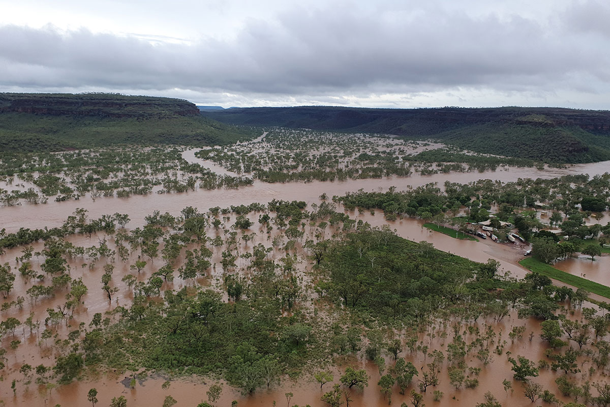
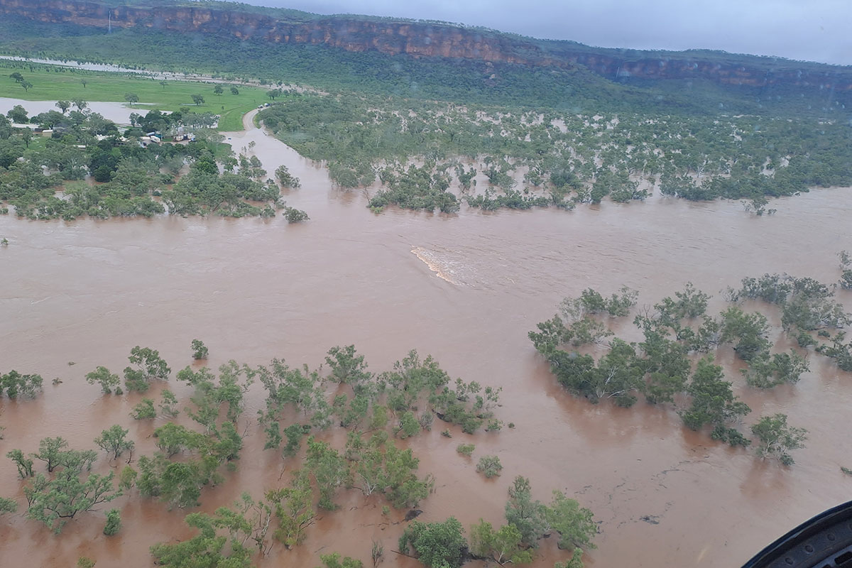
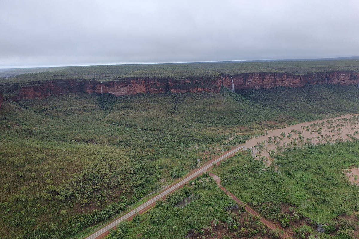
It brought heavy rainfall and high winds, which wreaked havoc in the Victoria River catchment and raised the Daly River over 15 m AHD at Beeboom Crossing (ID: G8140042), exceeding the moderate flood level of 13.1 metres at the community of Nauiyu (Daly River). The river levels remained above the flood level until 2 February.
Wadeye received 170 mm rainfall on 14 January, followed by a further 335 mm on 15 January and a monthly total of a whopping 1051 mm, which is over 3 times the long-term monthly average of 315 mm. Further inland, Delamare received a monthly rainfall total of 571 mm for January, almost 4 times the long-term average of 147 mm. Nearby Cattle Creek received a similar monthly total of 584 mm.
In response to the flood conditions, government stood up the Northern Region Emergency Committee (NREC) and declared emergency conditions for the affected communities at Kalkarindji, Daguragu and Pigeon Hole.
These hard-hit communities are still in recovery from the March 2023 flooding of the Victoria River and were significantly impacted by flooding yet again.
Water Resources maintains a network of surface water monitoring sites specifically rated for flood monitoring of major river systems across the Top End. These stations are telemetric devices which send water level readings in near real-time to our database. This data is then accessible to flood managers through the Water Data Portal.
The BoM uses the telemetered data to run and calibrate flood models during flood events in the Victoria River and Daly River. The models provide valuable predictions on the likely depth and velocity of flow in rivers as the flooding event progresses, meaning that the current and predicted extent of inundation can be estimated once rivers break their banks and potentially breach bridge levels, roads and property. The model predictions provide the basis for the NREC to plan evacuations and ensure community safety.

Locality map
In the midst of the extreme weather, the Telstra network failed in the Kalkarindji area on 15 January. This is not completely unexpected with the heavy rainfall and high winds that were gusting over 100 km/h at times. However, it meant that critical flood monitoring data for Wave Hill Station at Kalkarindji was off-line.
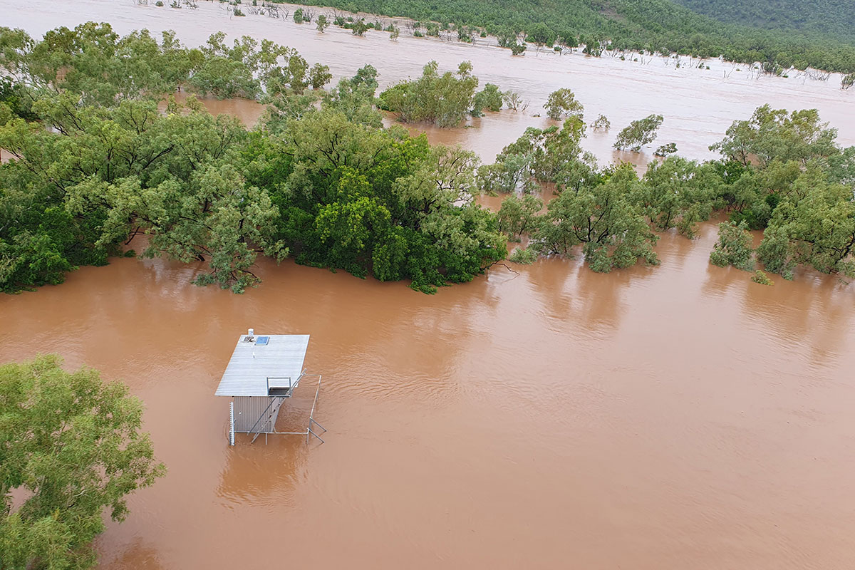
On 17 January, Remote Sergeant Jackson Holt, based at Kalkarindji Police Station, noticed that the river had breached the bridge at the Victoria River Crossing. However, incoming monitoring data on the Water Data portal was found to be reporting a level lower than the bridge deck, signifying that actual water levels were under-reported by approximately 5 m at the site.
The nearby Coolibah Station monitoring site showed a similar under-representation of actual water levels by about 3 m.
So, three critical flood monitoring sites were not functional at a time when they were most needed.
Without accurate data BoM modellers are unable to confirm the accuracy of predicted flood levels, and whether levels are likely to pose a further risk to homesteads and communities.
That’s when the Water Resources hydrographers swung into action
- 18 January: the team assembled every possible replacement part necessary to repair the monitoring sites.
- Mark Cunnington, Manager Emergency and Risk Management in Executive Services obtained approval from the Emergency Operations Committee Police Incident Controller for our team to enter the emergency area.
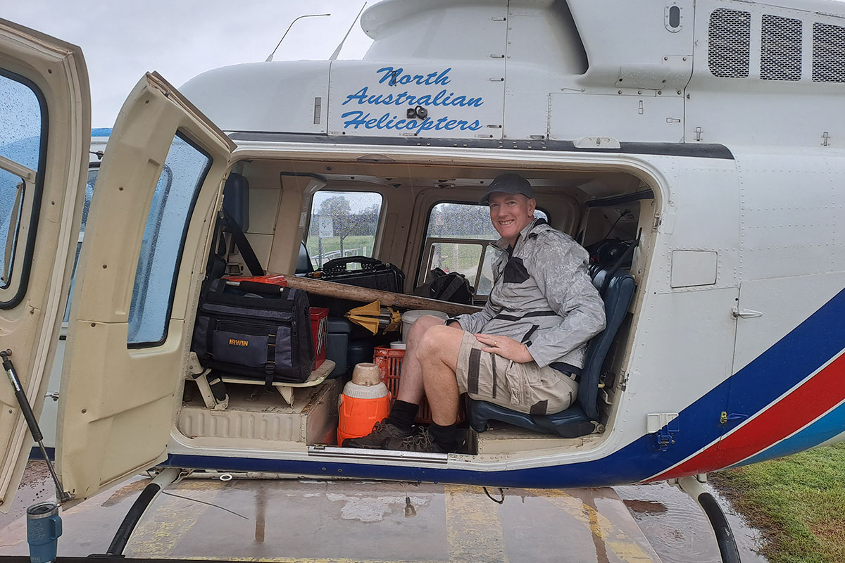
- 19 January: the team departed from Darwin into the unknown challenge ahead.
- 20 January: a helicopter service was contracted out of Katherine to transport the team to the affected sites - conditional that weather conditions were within aviation safety guideline levels.
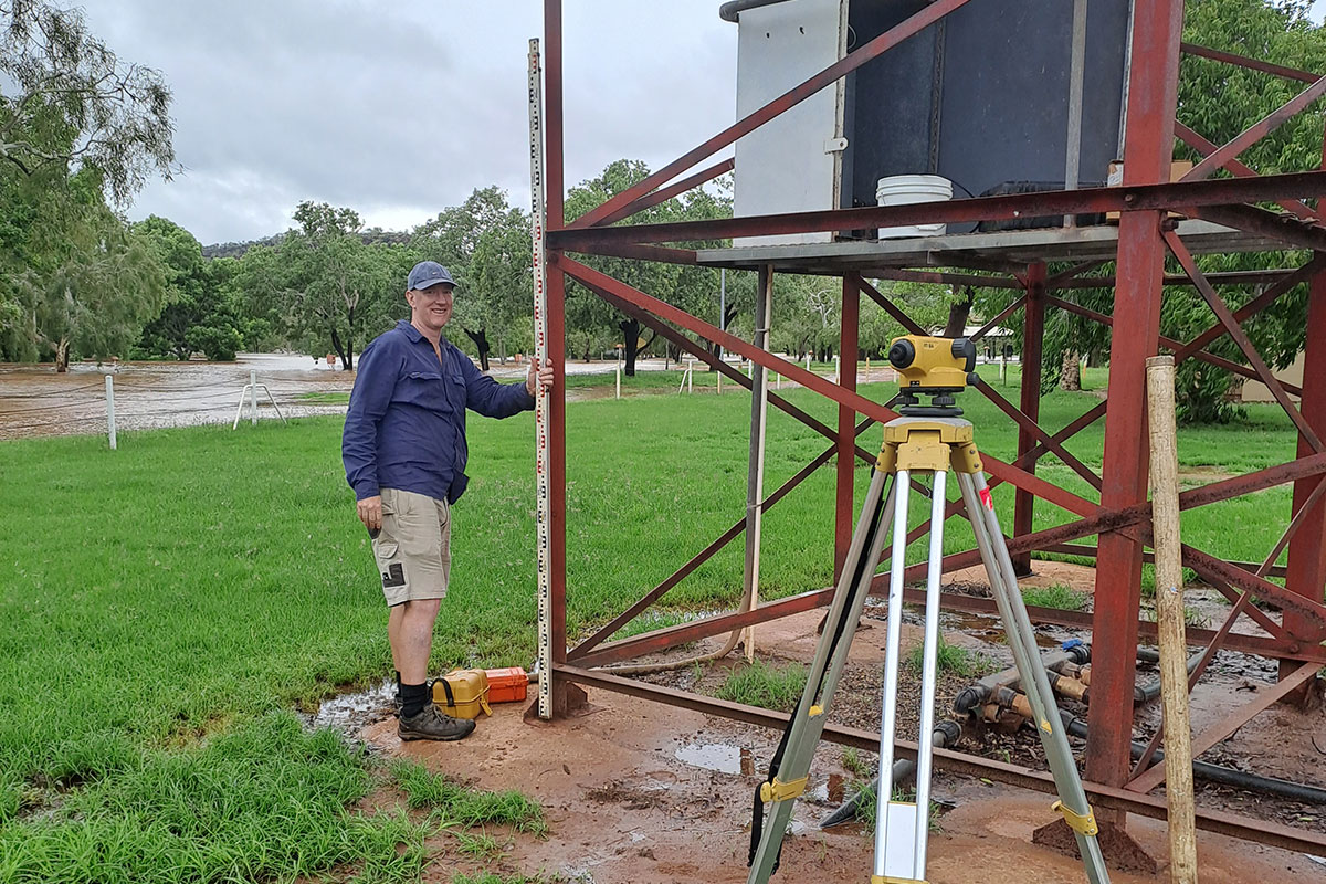
- At around 10:30 am on 20 January the Victoria River Roadhouse site was corrected and came back online.
The team arrived at the Coolibah Homestead site to find it inundated with standing water almost 1 m deep at the shed, so the helicopter could not land and the site could not be repaired at this time. Flying low over the site, the team were able to photograph the gauge board which recorded the water level at 19.275 metres local gauge datum (41.85 m AHD).
The team consisted of Sean Lawrie and Trevelyan Edwards, who stepped up and managed to bring the key Victoria River monitoring site back online providing accurate water levels within 2.5 hours of departing from Katherine. Exemplary professional conduct - this is what we are all about!
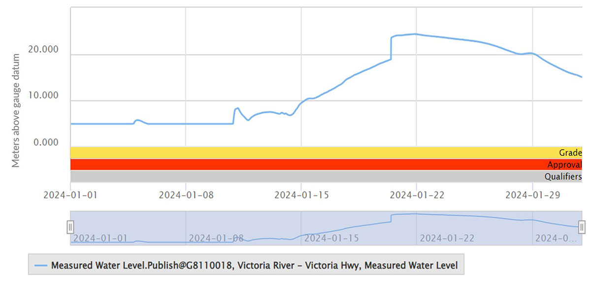
Water level at Victoria River highway (ID: G8110018), showing correction on 20 January 2024 from the Water Data Portal.
This article was initially published in our monthly newsletter, Finding the Balance. Subscribe to get future updates delivered to your inbox.