

Darwin Harbour report card 2018
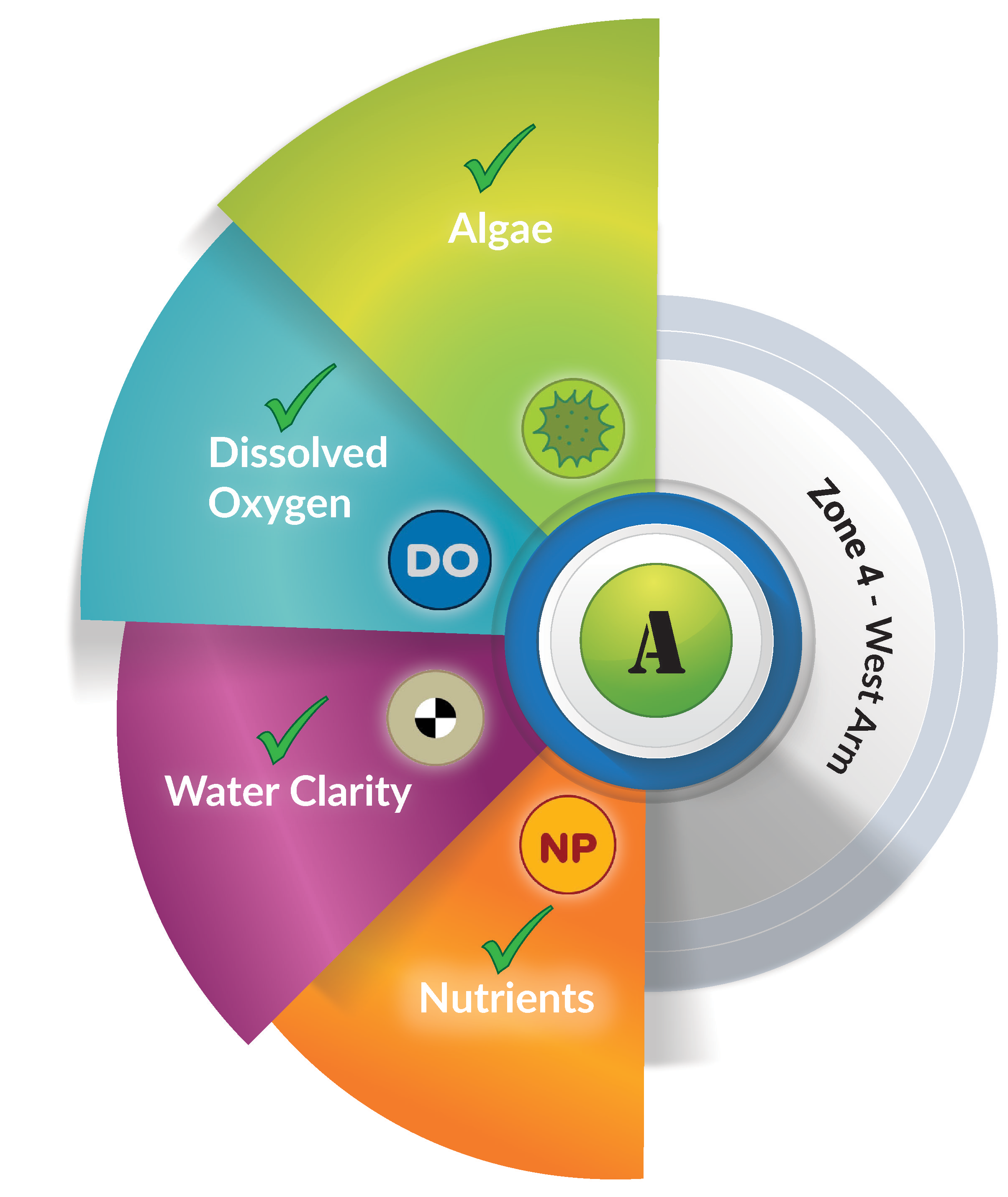
Zone 4: West Arm
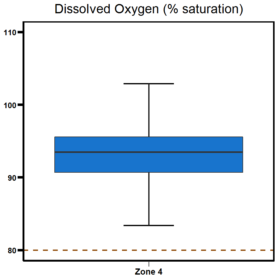
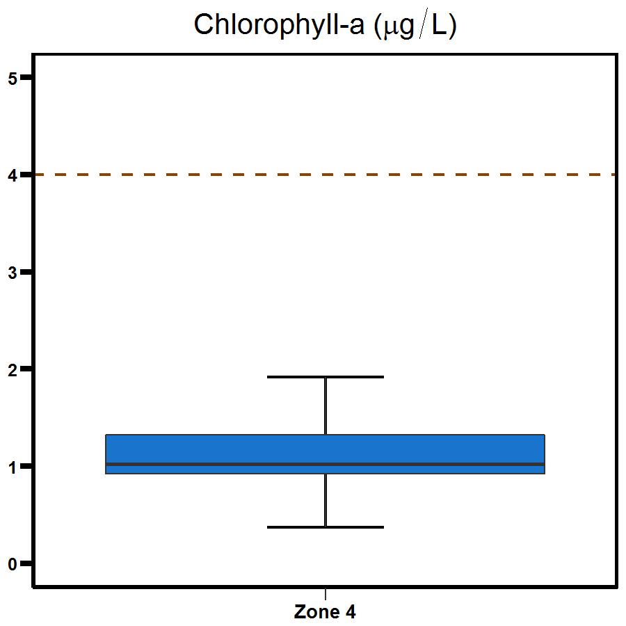
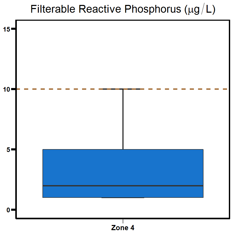
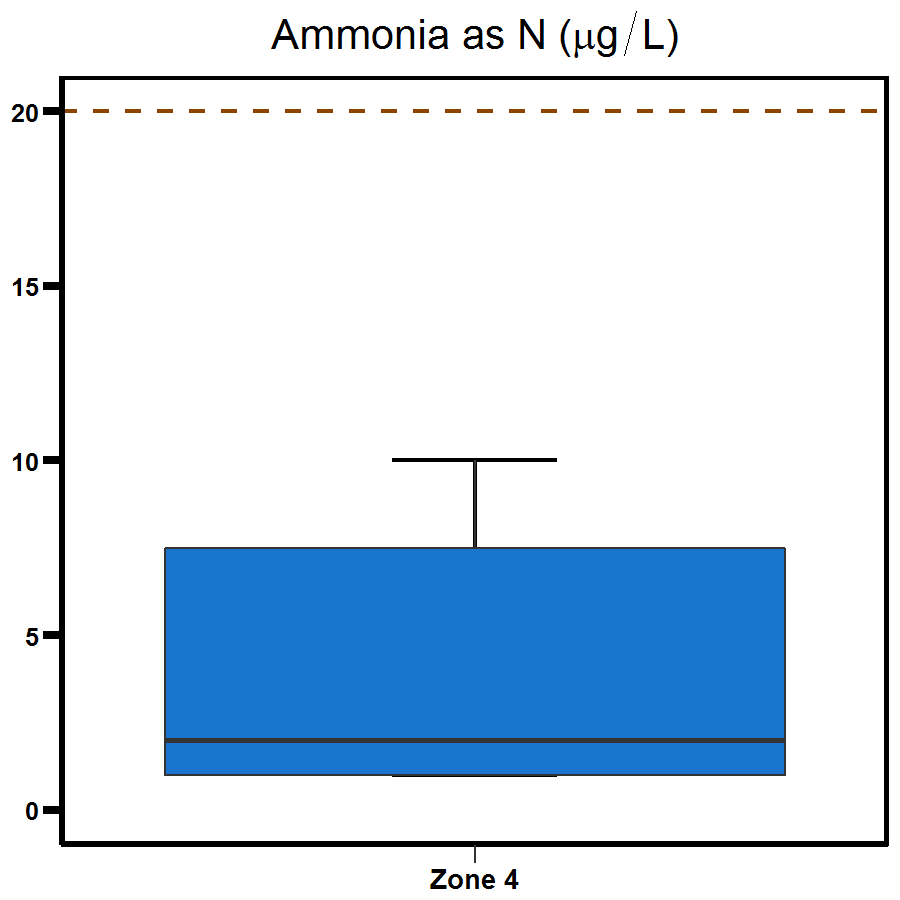
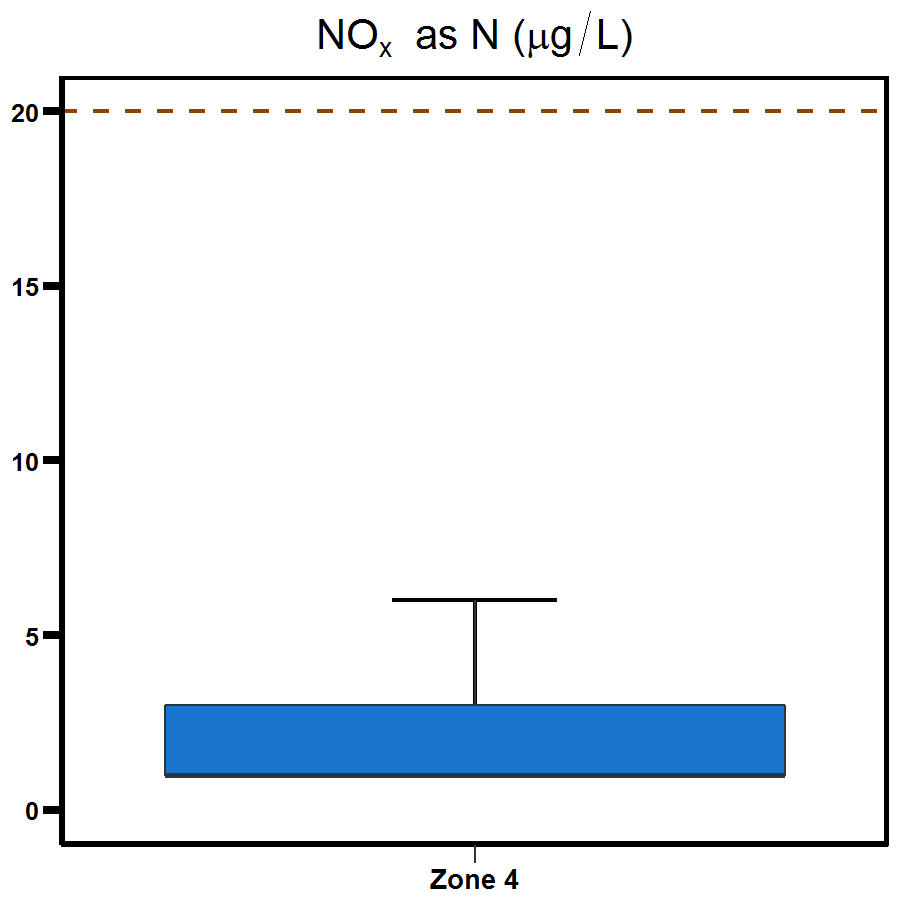
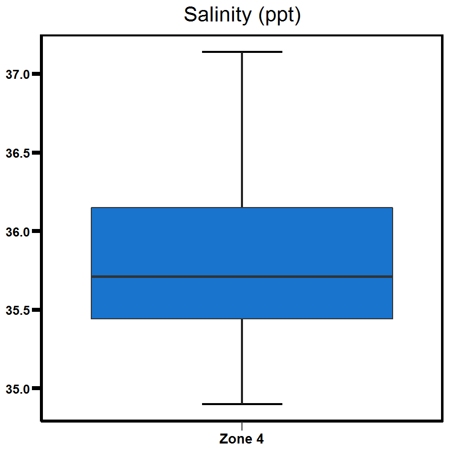
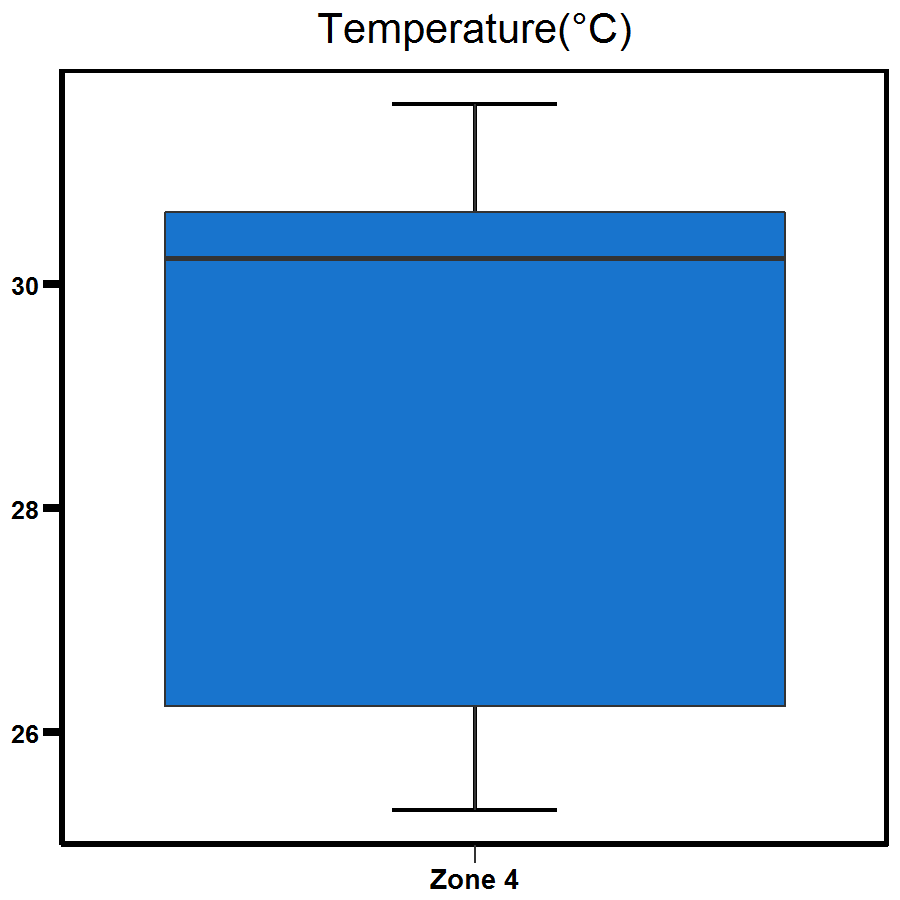
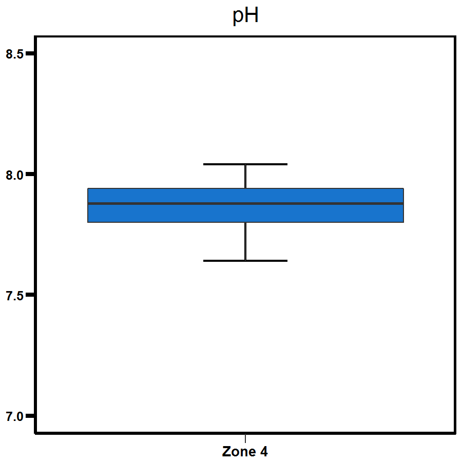
Water quality in the West Arm was excellent.
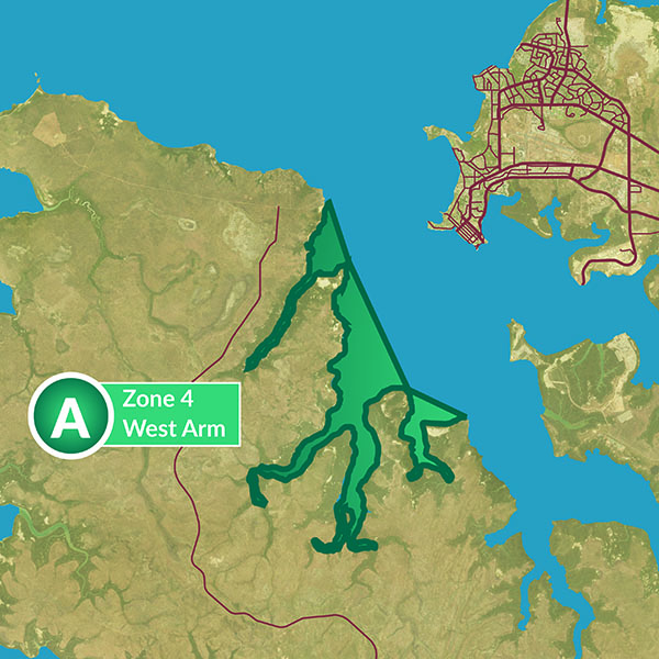
About West Arm
West Arm has extensive mangrove habitat, inter-tidal mudflats and large inter-tidal areas that are exposed on spring tides.
The West Arm reporting zone includes a series of large tidal creeks and Woods Inlet.
The western boundary of Darwin Harbour catchment comprises only minor rural development on Cox Peninsula.
West Arm is considered to be relatively undisturbed with stream inflows limited to wet season run-off from a largely intact undisturbed catchment.
Long-term trend

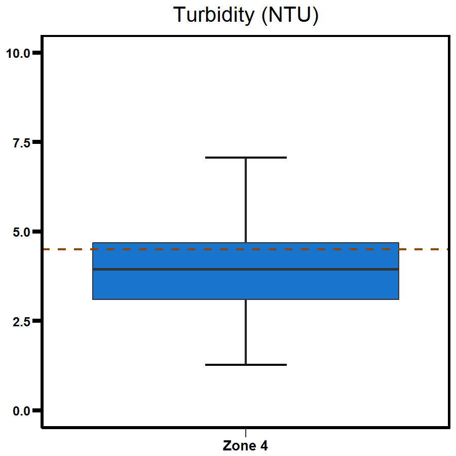
Data summary
The distribution of the data for all parameters is shown here as box and whisker plots.
For report card grades the median of the data (solid line in the box) is compared to the Water Quality Objective (dotted line) for each parameter.
 |  |
 |  |
 |  |
 |    |
Supplementary parameters
Give feedback about this page.
Share this page:
URL copied!