

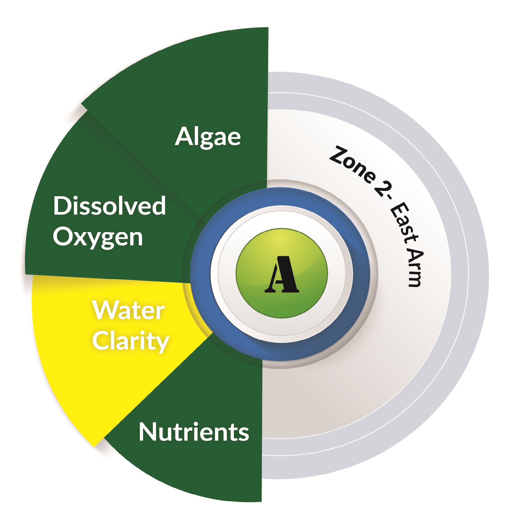
Zone 2: East Arm
Water quality in the East Arm was very good.
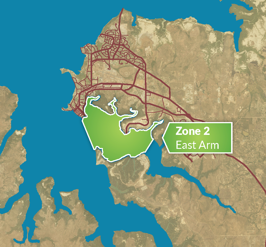
About East Arm
East Arm is the centre of marine services and development in Darwin Harbour, with large gas industry development and the NT’s main port on its shores.
East Arm receives urban stormwater runoff from the city of Darwin and there is a small discharge of treated wastewater from the Berrimah plant into Bleeser’s Tidal Creek.
Large areas of mangroves have been cleared for industrial development alongside East Arm. However, intact mangrove habitats still remain along approximately half the coastline of East Arm.
Part of the foreshore is bounded by Charles Darwin National Park.

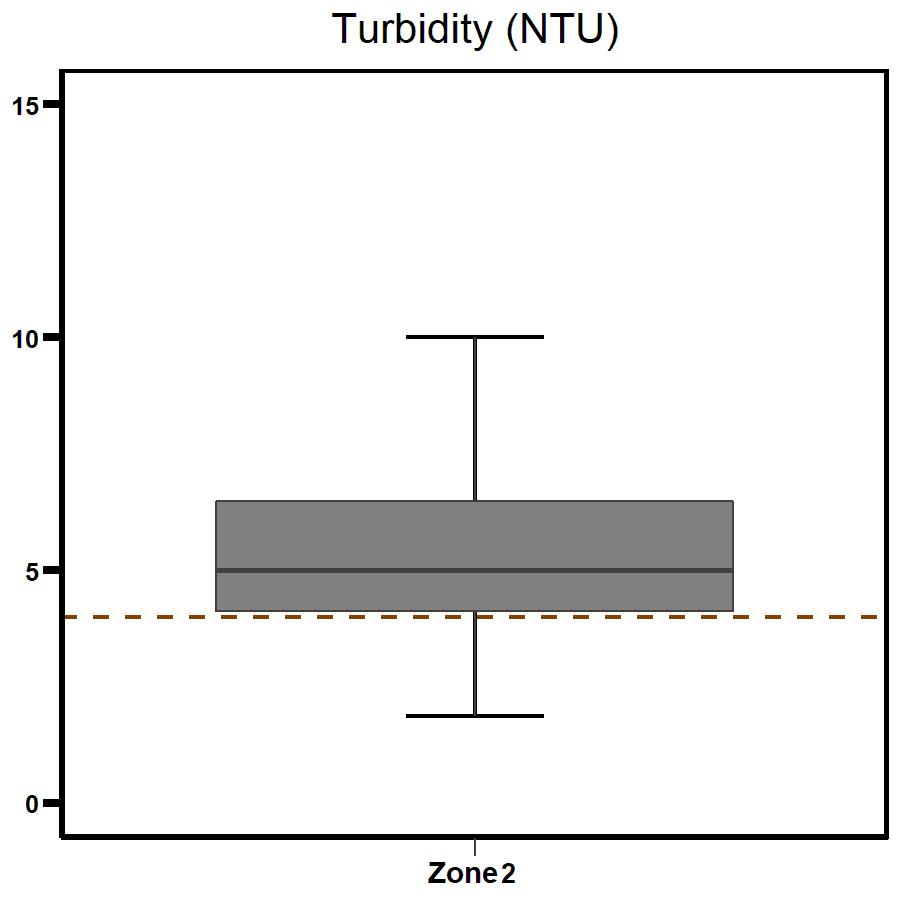
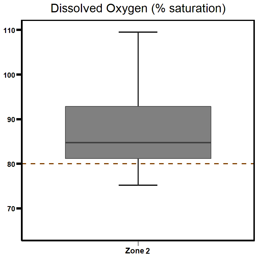
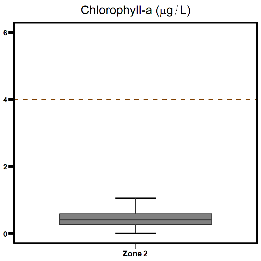
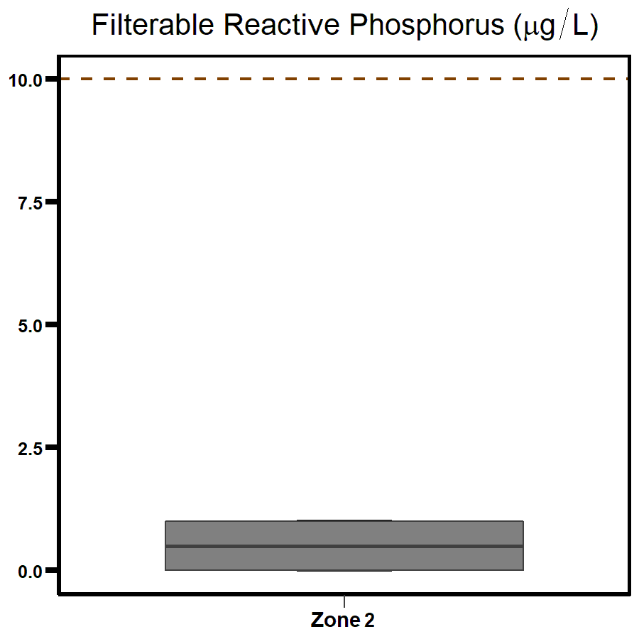
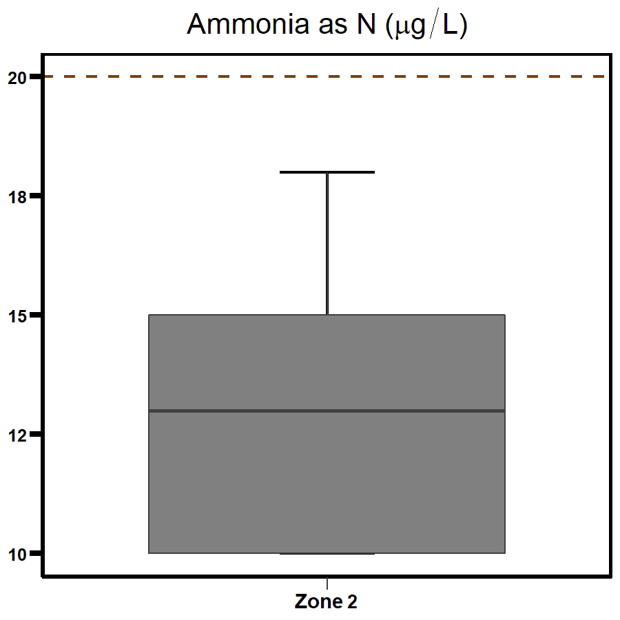
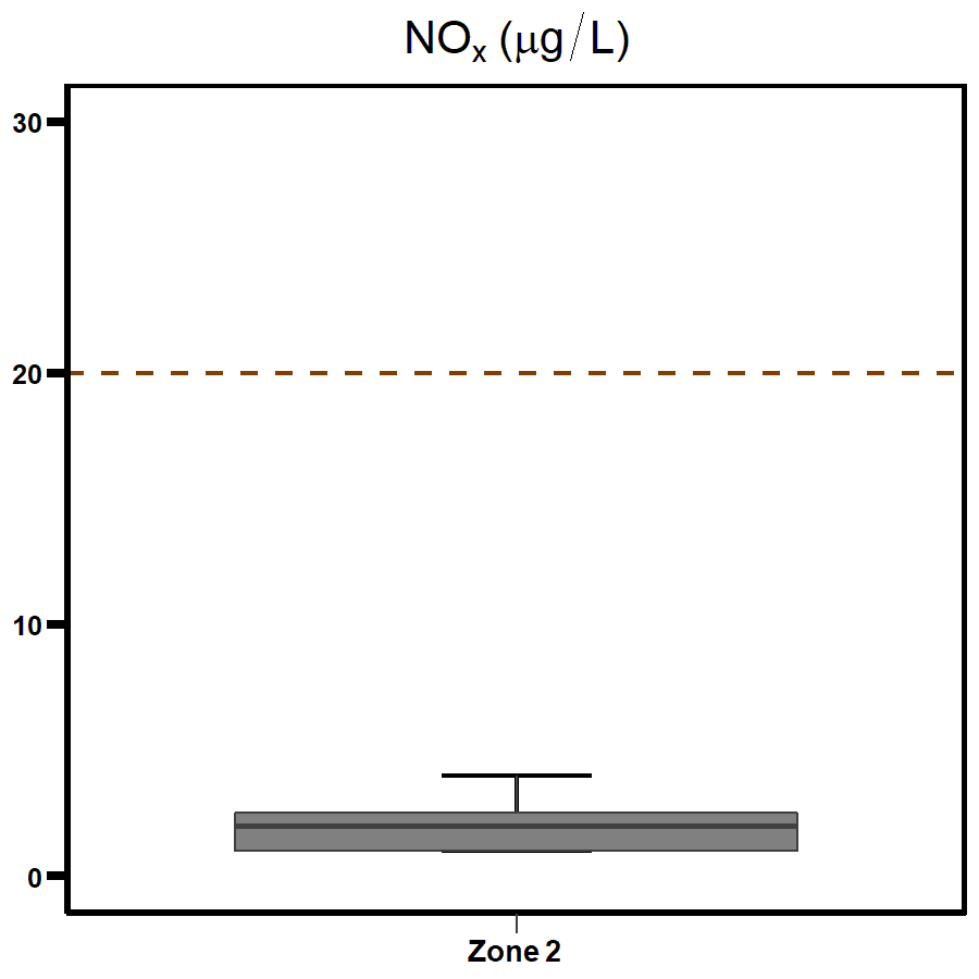
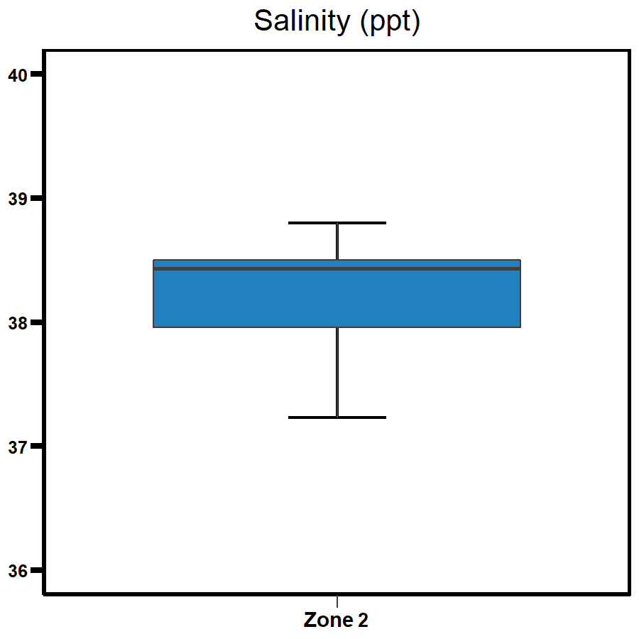
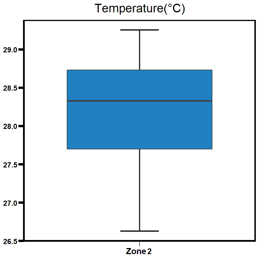
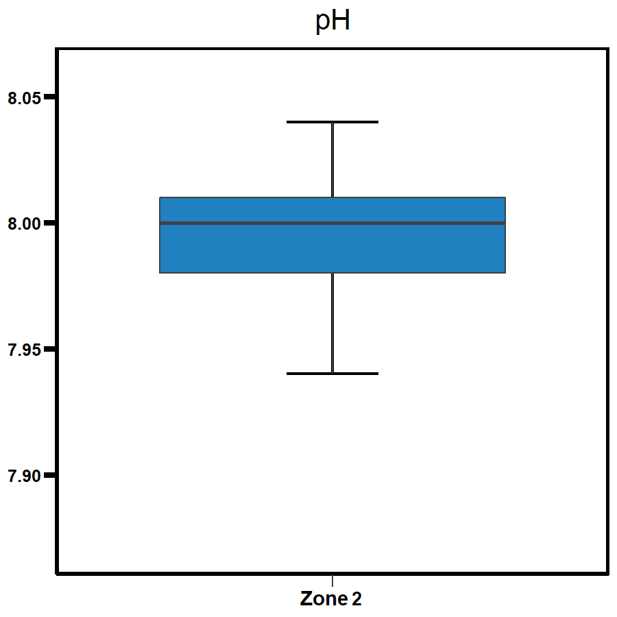
Data summary
The distribution of the data for all parameters is shown here as box and whisker plots.
For report card grades the median of the data (solid line in the box) is compared to the Water Quality Objective (dotted line) for each parameter.
| Indicator | Plot |
|---|---|
 |  |
 |  |
 |  |
 |    |
Supplementary parameters
Give feedback about this page.
Share this page:
URL copied!