

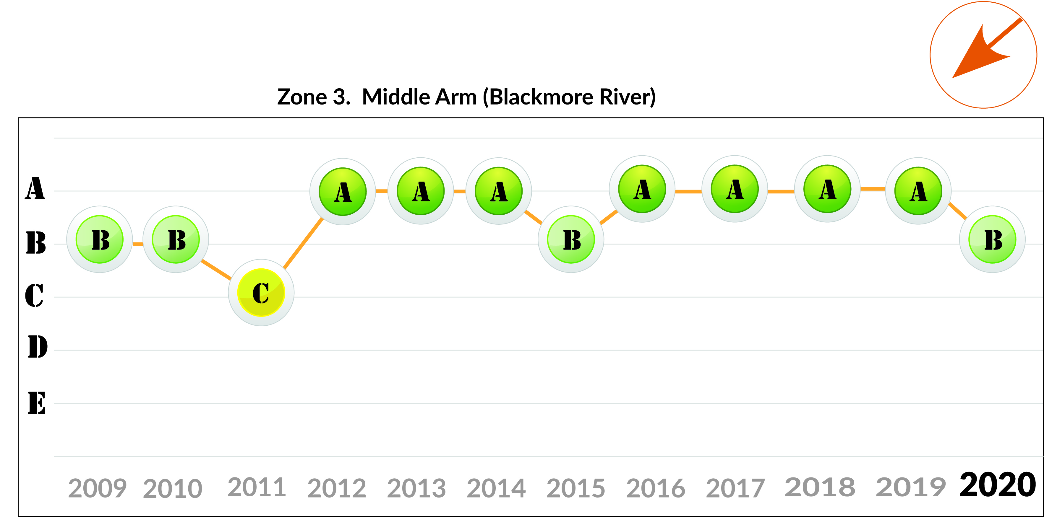
Zone 3: Middle Arm
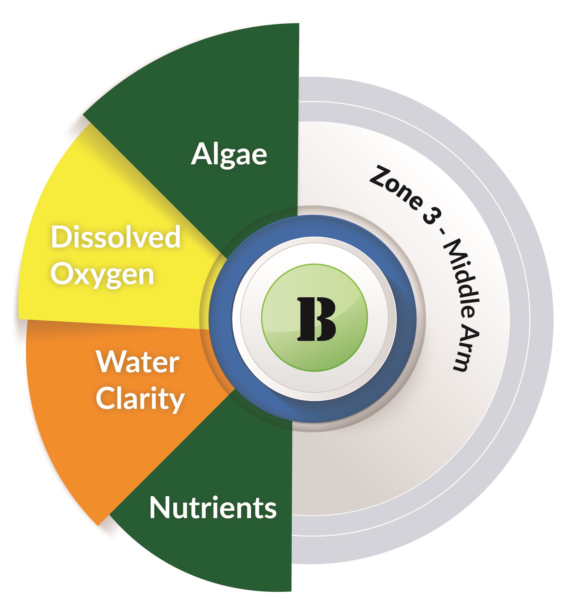
Water quality in the Middle arm was good.
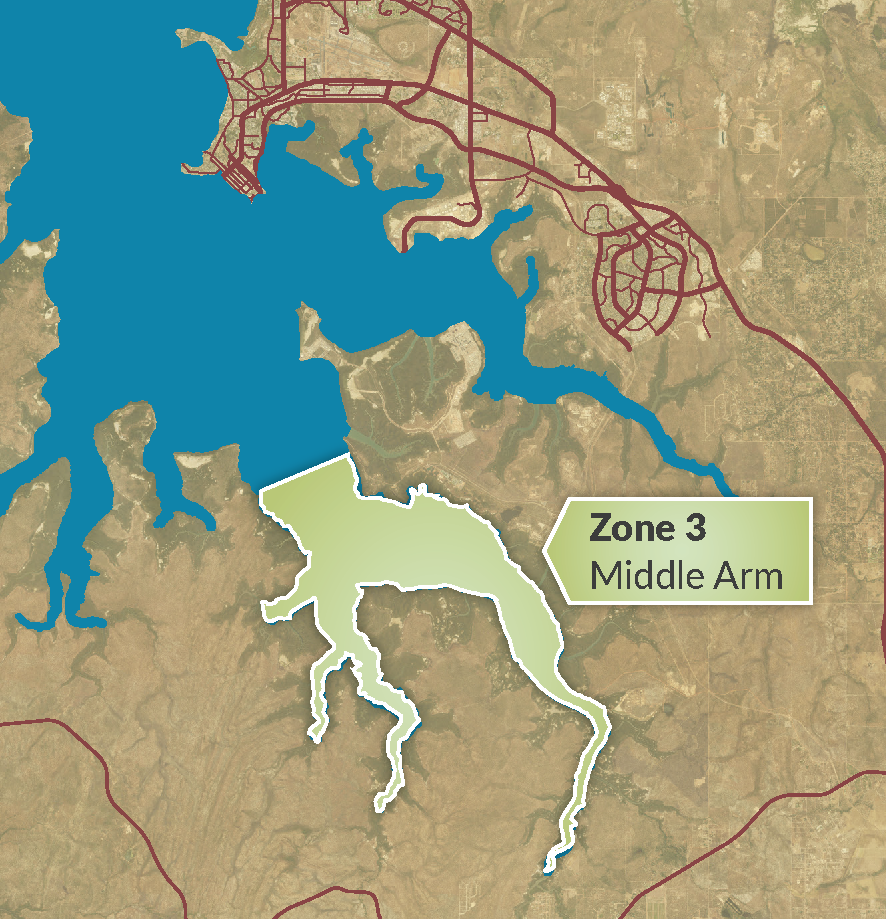
About Middle Arm
Middle Arm comprises the Blackmore and Pioneer River estuaries. The zone has extensive mangrove fringes and intertidal mudflats.
The Blackmore River flows into Darwin Harbour over the whole year, with dry season flows from Darwin River Dam and Berry Springs.
Most of the zone's catchment is rural or savannah woodland.
Data summary
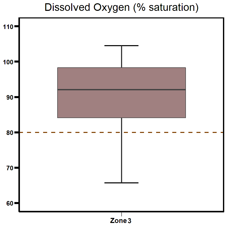
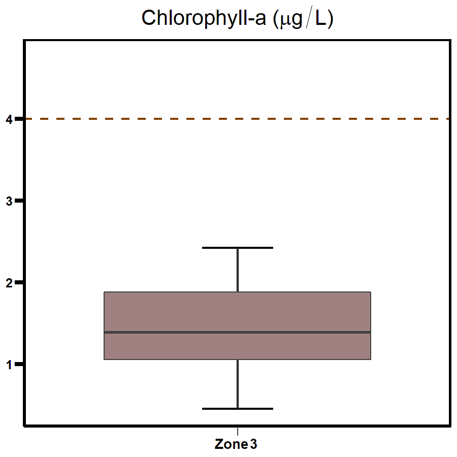
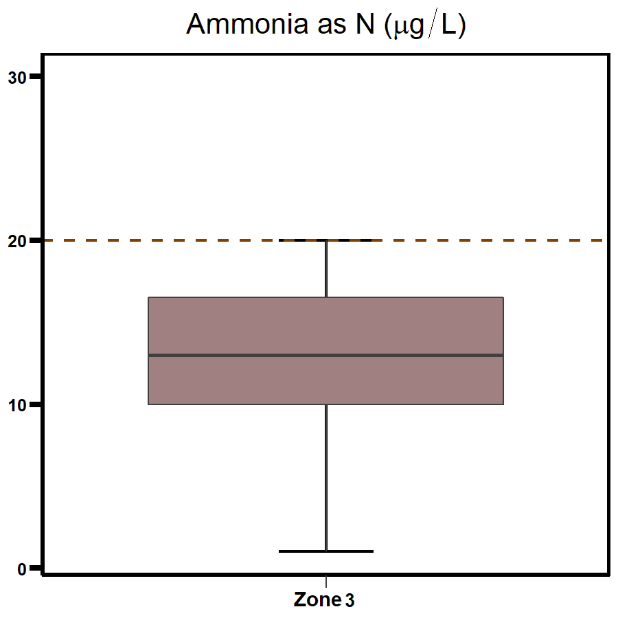
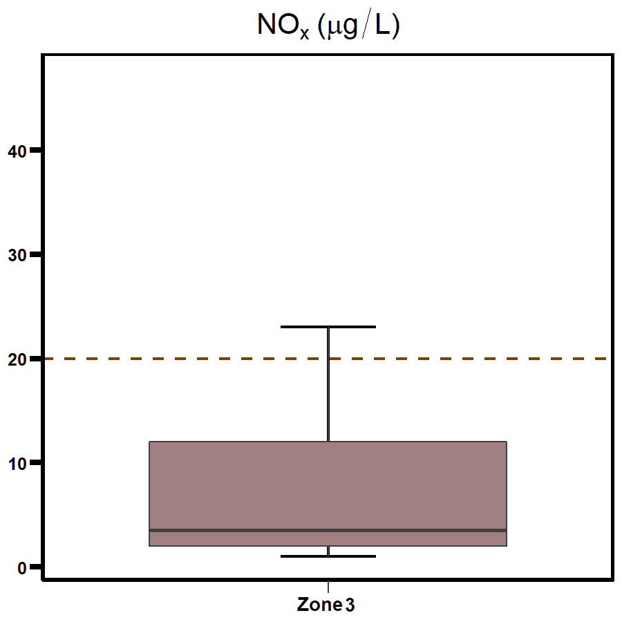
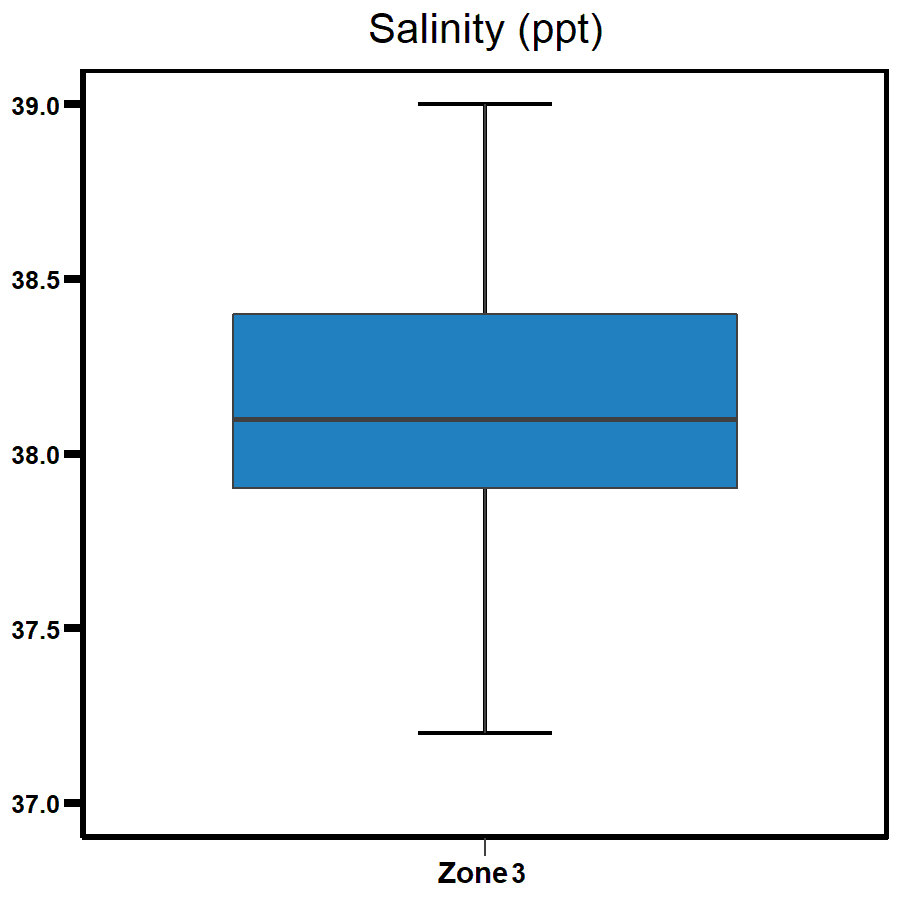
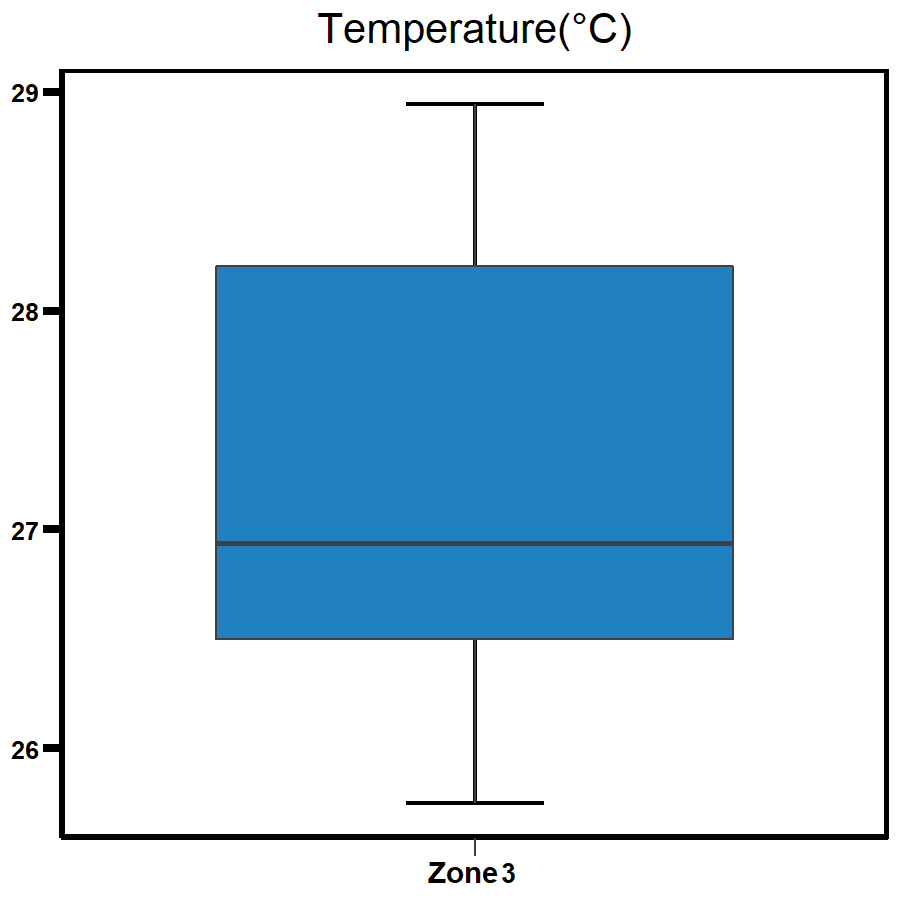
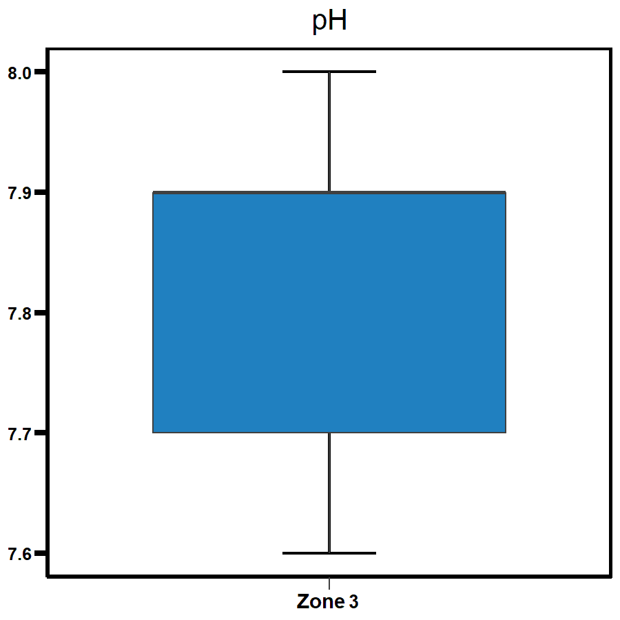
The distribution of the data for all parameters is shown here as box and whisker plots.
For report card grades the median of the data (solid line in the box) is compared to the Water Quality Objective (dotted line) for each parameter.
| Indicator | Plot |
|---|---|
 |  |
 |  |
 |  |
 |    |
Supplementary parameters
Give feedback about this page.
Share this page:
URL copied!