Wadeye
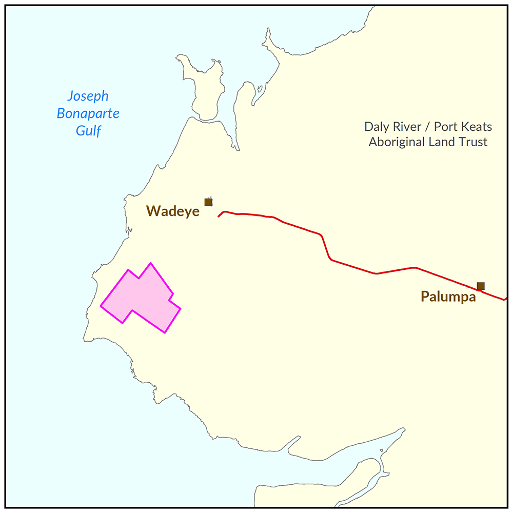
Soil and land capability, biodiversity and water resource investigations were undertaken in the Nangu Area, located 15 km south west of the community of Wadeye and covering an area of 5,960 ha. Collectively, the results of the investigations provide a comprehensive biophysical assessment of the Nangu landscape.
The information products will support Traditional Aboriginal owners’ understanding of the land capability of the Nangu study area and assist with scoping development opportunities, confident that biophysical risks and opportunities have been identified and understood.

View a larger version of the Wadeye locality map.
Development potential summary
This summary provides an integrated overview of the land capability, water availability and biodiversity assets of the Nangu study area. The report summarises outcomes from three technical reports and a suite of maps which detail the water resources, biodiversity, and soil, land and vegetation communities of the study area.
View the survey location on NR Maps.
Key development potential facts
- 4,638 ha is predominantly deep, well-drained, sandy surfaced red earths on gentle plains and slopes with good potential for rain-fed or surface water based agricultural development.
- 2,240 ha classified as having good potential for groundwater based development and a further 2,970 ha identified as having moderate potential.
- 743 ha contained significant or high value biodiversity values that should be protected from development or soils that are unsuitable for agriculture as they are shallow, very gravelly, subject to flooding, poorly drained or too steep.
- Local aquifers have a sustainable groundwater yield of approximately 2000 ML per annum with water quality of a standard suitable for human consumption and irrigation purposes. This groundwater yield is sufficient to support approximately 400 ha of irrigated agriculture.
Information products
- Read the report (pdf) on the Territory Stories website.
- View the summary map (pdf).
- Download the interactive map - biophysical classes (pdf). This file should be opened with Adobe Reader.
- Download the spatial data package (contains data, metadata, reports and maps).
- View the development potential metadata record.
- View the groundwater development potential metadata record.
Soil and land
The soil and land capability survey was undertaken in 2017. The report and maps document the soil and land factors likely to impact irrigated agricultural development and highlight the crops most suited to land within the Nangu study area.
- Read the report (pdf) on the Territory Stories website.
- View the land resources map (pdf).
- Download the interactive map - land resources, capability and crop suitability (pdf). This file should be opened with Adobe Reader.
- Download the spatial data package (contains data, metadata, reports and maps).
- View the metadata record.
Water
The following report and map provide technical details of the Groundwater Resources of the Wadeye Region. The report estimates groundwater quality and bore yield within the study area.
- Read the report (pdf) on the Territory Stories website.
- View the water resources map (pdf).
- Download the spatial data package (contains data, metadata, reports and maps).
- View the metadata record.
Biodiversity
The following report and map document the results of fauna and flora surveys within the Wadeye area, including occurrence and distribution of threatened species, significant habitat and biodiversity risk classes.
- Read the report (pdf) on the Territory Stories website.
- View the biodiversity and vegetation map (pdf).
- Download the spatial data package (contains data, metadata, reports and maps).
- View the metadata record.
Contact
For further information contact:
Simon Cruickshank
Phone: 08 8999 3676
Email: simon.cruickshank@nt.gov.au
Give feedback about this page.
Share this page:
URL copied!