

Development opportunities
The Mapping the Future program provides bio-physical resources information to:
- improve planning outcomes
- de-risk investment decisions and
- promote sustainable economic development in the NT.
Where appropriate, projects will identify and map land capability, water availability and biodiversity assets at strategic locations within the NT.
Project outcomes will provide confidence about the biophysical resources and a baseline of information to inform investment decisions and effective regulatory decisions.
Read more about the program, its objectives and the method for prioritising assessment areas.
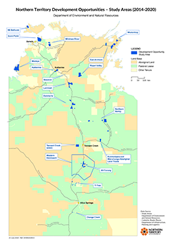
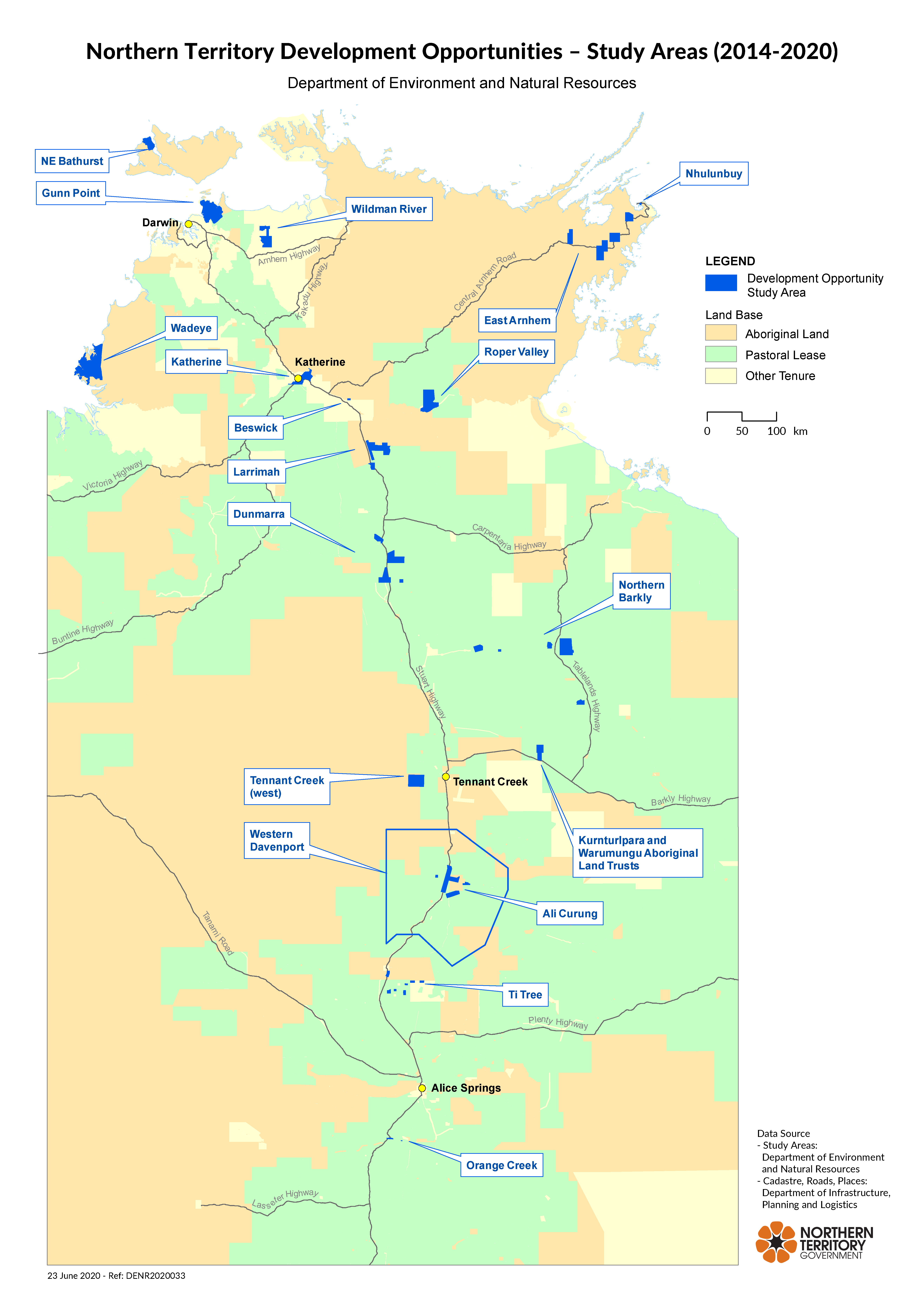
View a larger version of the NT Development Opportunities study areas 2014 to 2020.
Project areas
Search by region

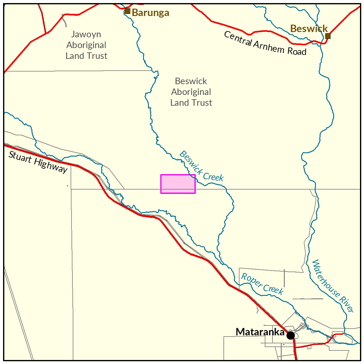
Beswick
In 2017-18 the Department of Environment and Natural Resources undertook a soil and land suitability assessment on Aboriginal Lands in the Beswick area.

Dunmarra
The soil and land suitability assessment investigated 59,980ha in the Dunmarra area to assist the potential development of irrigated agriculture in the vicinity.

East Arnhem
Soil and land suitability mapping has been carried out across four survey areas in East Arnhem Land.

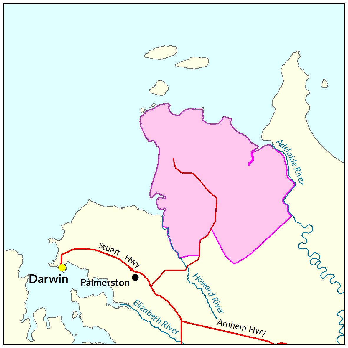
Gunn Point
The Gunn Point Peninsula offers significant potential for a range of agricultural, horticultural, industrial, residential and tourist opportunities. This project area has a reports on the development potential of this area for soil and land, water, terrestrial and marine/coastal biodiversity.
Katherine
A soil and land suitability assessment and biodiversity assessment for Katherine is currently underway with reports due to be published late 2021.


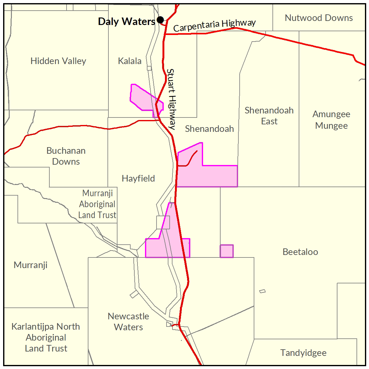
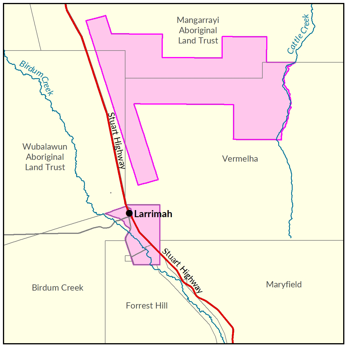
Larrimah
Two soil and land suitability investigations have been undertaken by the Department of Environment and Natural Resources. The two study areas combined identified 24,180ha of land being potentially suitable for a range of irrigated crops.

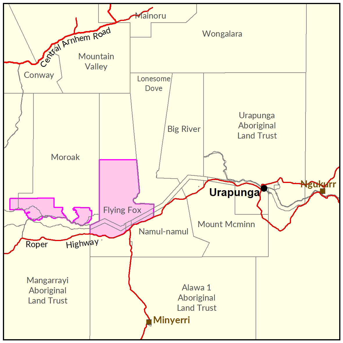
Lower Roper
Surveys for soil and land suitability assessment for irrigated agriculture for southern Flying Fox Station were published in 2021.

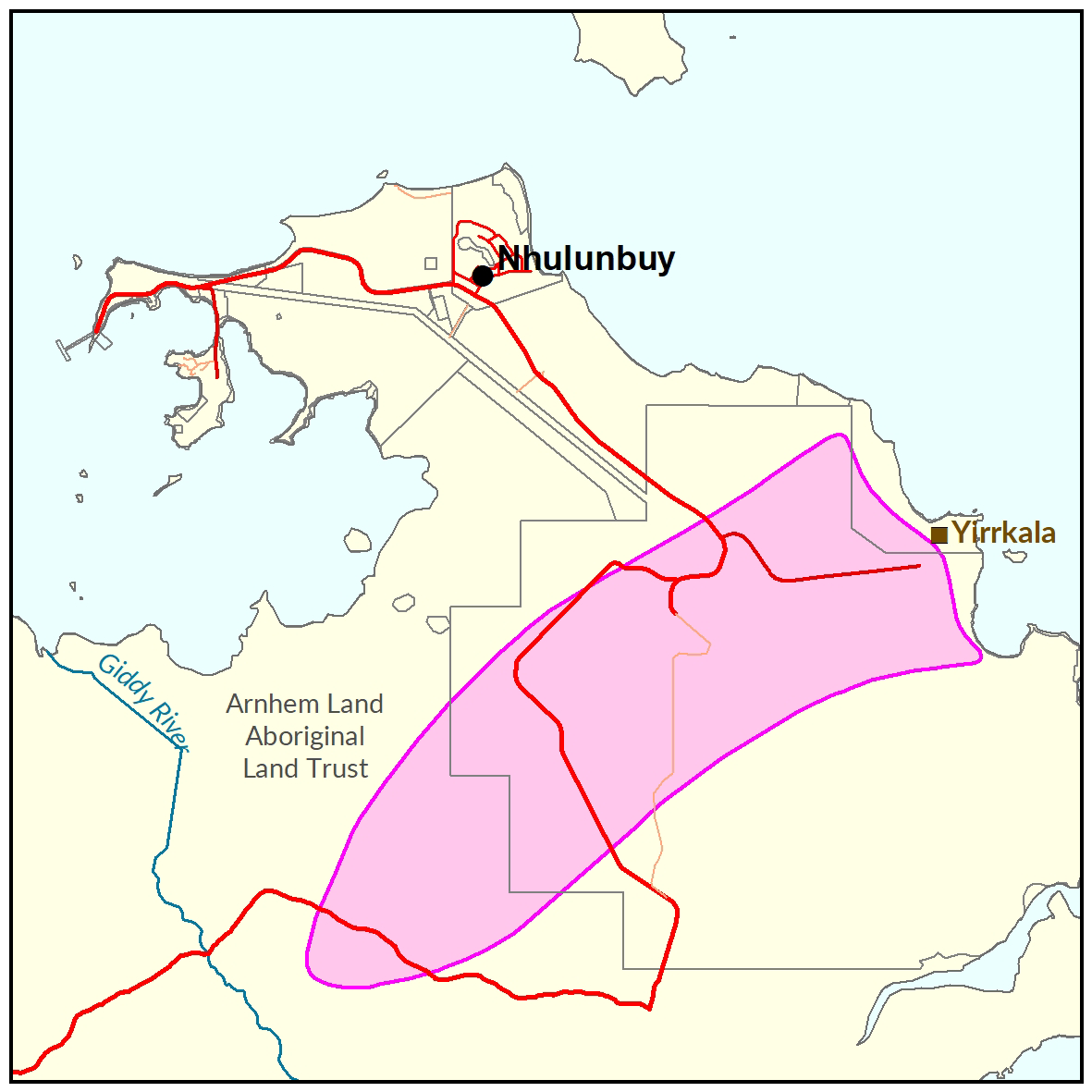
Nhulunbuy
A soil and land suitability assessment for Nhulunbuy is scheduled to be undertaken late 2020.

North East Bathurst Island
In 2014, the Department of Land Resource Management undertook the following at north east Bathurst Island: a land suitability assessment, water resource investigation and flora and fauna evaluation.

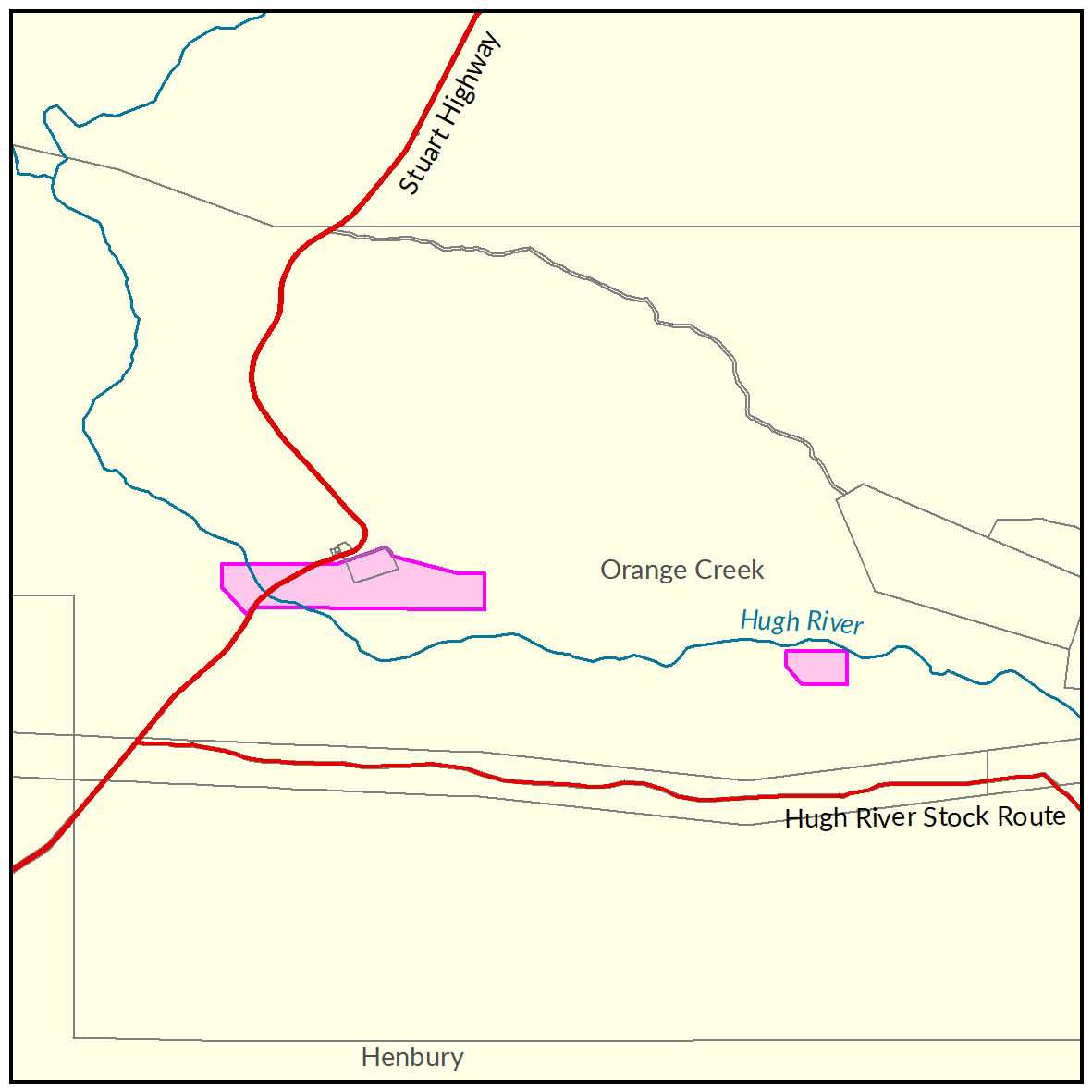
Orange Creek
In 2016-17, the Department of Environment and Natural Resources undertook a soil and land suitability assessment on a portion of the Hugh River Valley within Orange Creek Station.


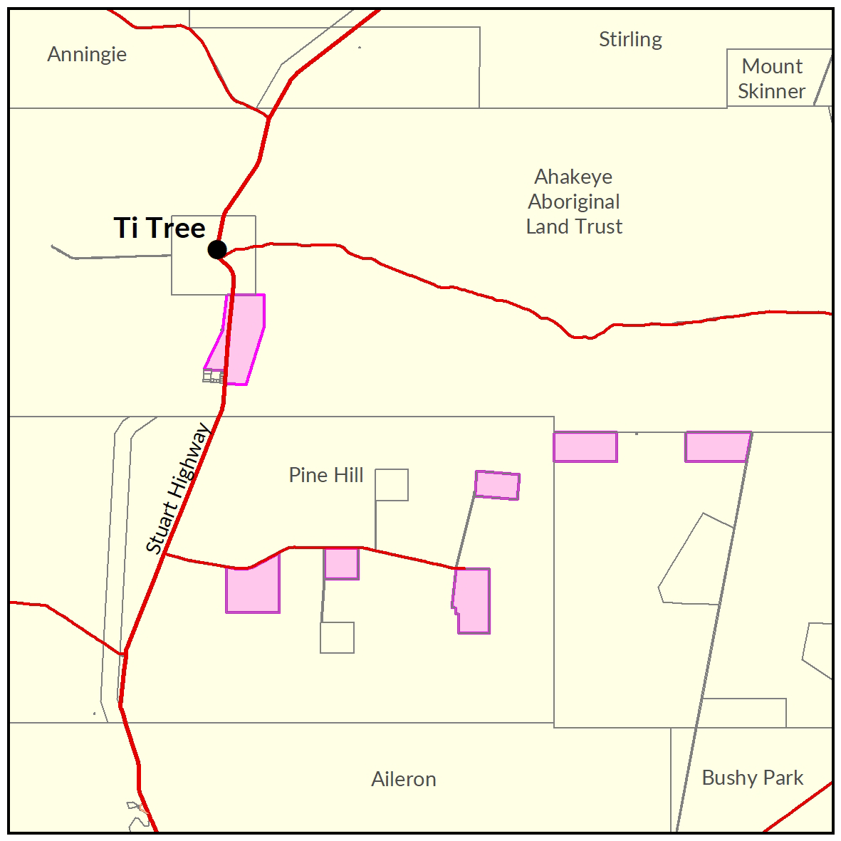
Ti Tree
In 2016-17, the Department of Environment and Natural Resources completed a soil and land suitability assessment for irrigated agriculture in the Ti Tree area.

Wadeye
Soil and land capability, biodiversity and water resource investigations were undertaken in the Nangu Area, located 15 km south west of the community of Wadeye and covering an area of 5,960 ha.


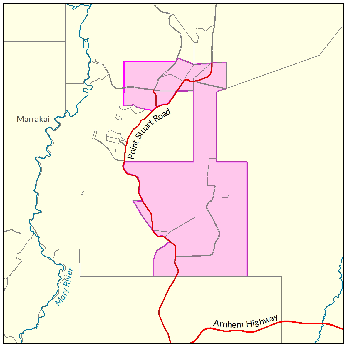
Wildman River
In 2015, the Department of Land Resource Management undertook a soil and land suitability investigation for irrigated agriculture in the Wildman River region. This project area had a water resource assessment completed in 2016.

Give feedback about this page.
Share this page:
URL copied!