

Study area map
The location of the SREBA biophysical study area and the Beetaloo Sub-basin is pictured below.
Get the map PDF (1.2 MB).
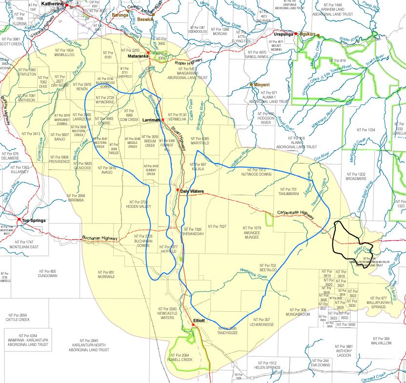
The Beetaloo Sub-basin is a geological unit that contains deep sedimentary rock formations that are prospective for petroleum resources. It covers approximately 28,000 km2.
The SREBA biophysical area is a broader area that contains the Sub-basin, it covers 86,400 km2. Extending from north of Mataranka to Elliott in the south, and from east of Top Springs on the Buchanan Highway to west of Cape Crawford on the Carpentaria Highway. The SREBA biophysical studies of water, ecosystems, greenhouse gases and environmental health, examined this area and in some cases, a larger area if needed.
Give feedback about this page.
Share this page:
URL copied!